Purpose
The purpose of the hiegeo Python module is to illustrate the conceptualization of a novel approach to geological modeling, that takes into account for the hierarchy and the chronological order of the geological structures to be represented. It is not intended to replace any existing state of art geological modeling tool. Instead, it could be an useful tool to illustrate and demonstrate some clear modeling guidelines for hierarchical structures, which could be then implemented in more sophisticated tools.
See the manuscript “A new perspective to model subsurface stratigraphy in alluvial hydrogeological basins, introducing geological hierarchy and relative chronology” (Computers and Geosciences, accepted) by Chiara Zuffetti, Alessandro Comunian, Riccardo Bersezio, and Philippe Renard for more details.
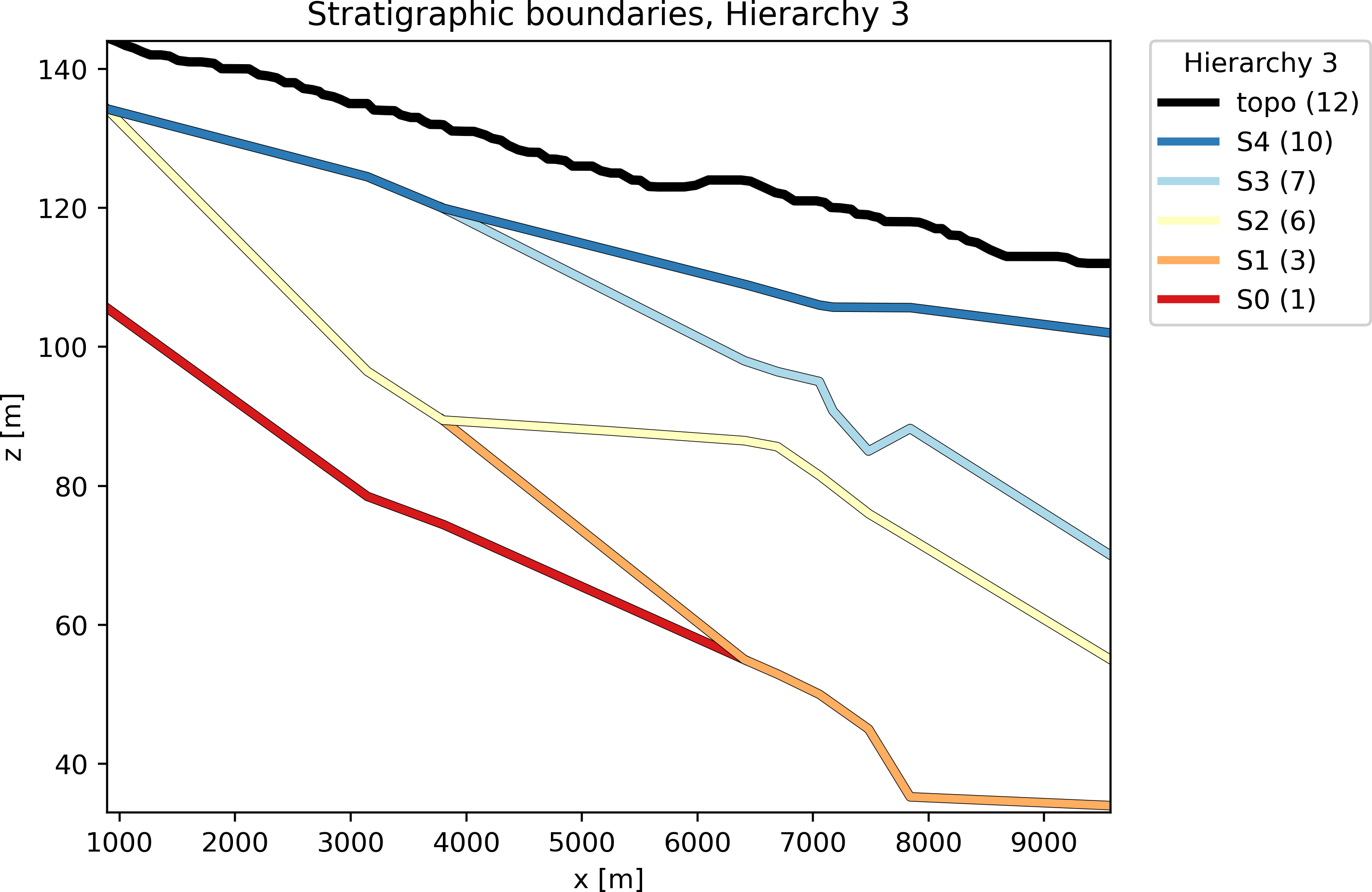
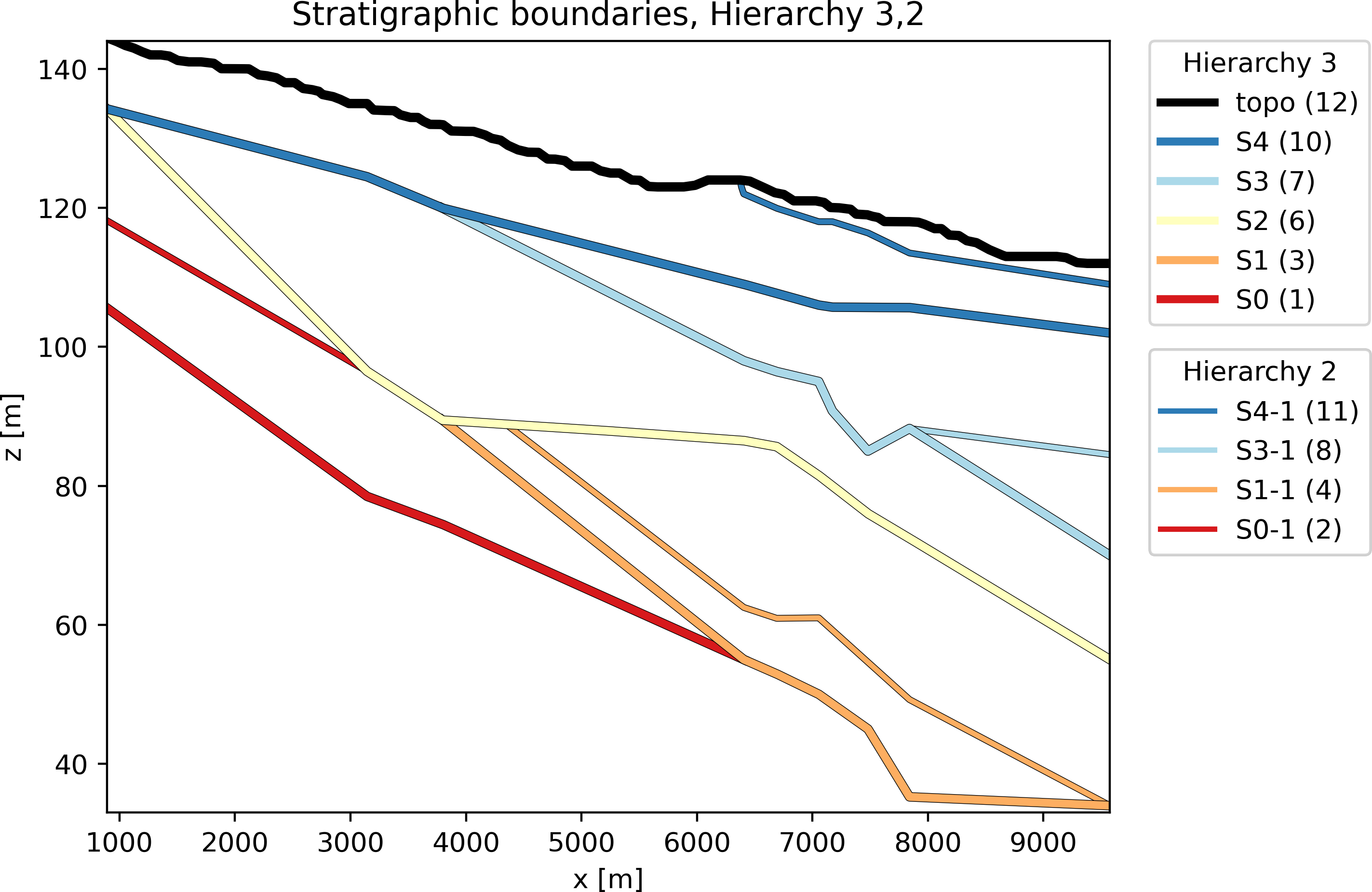
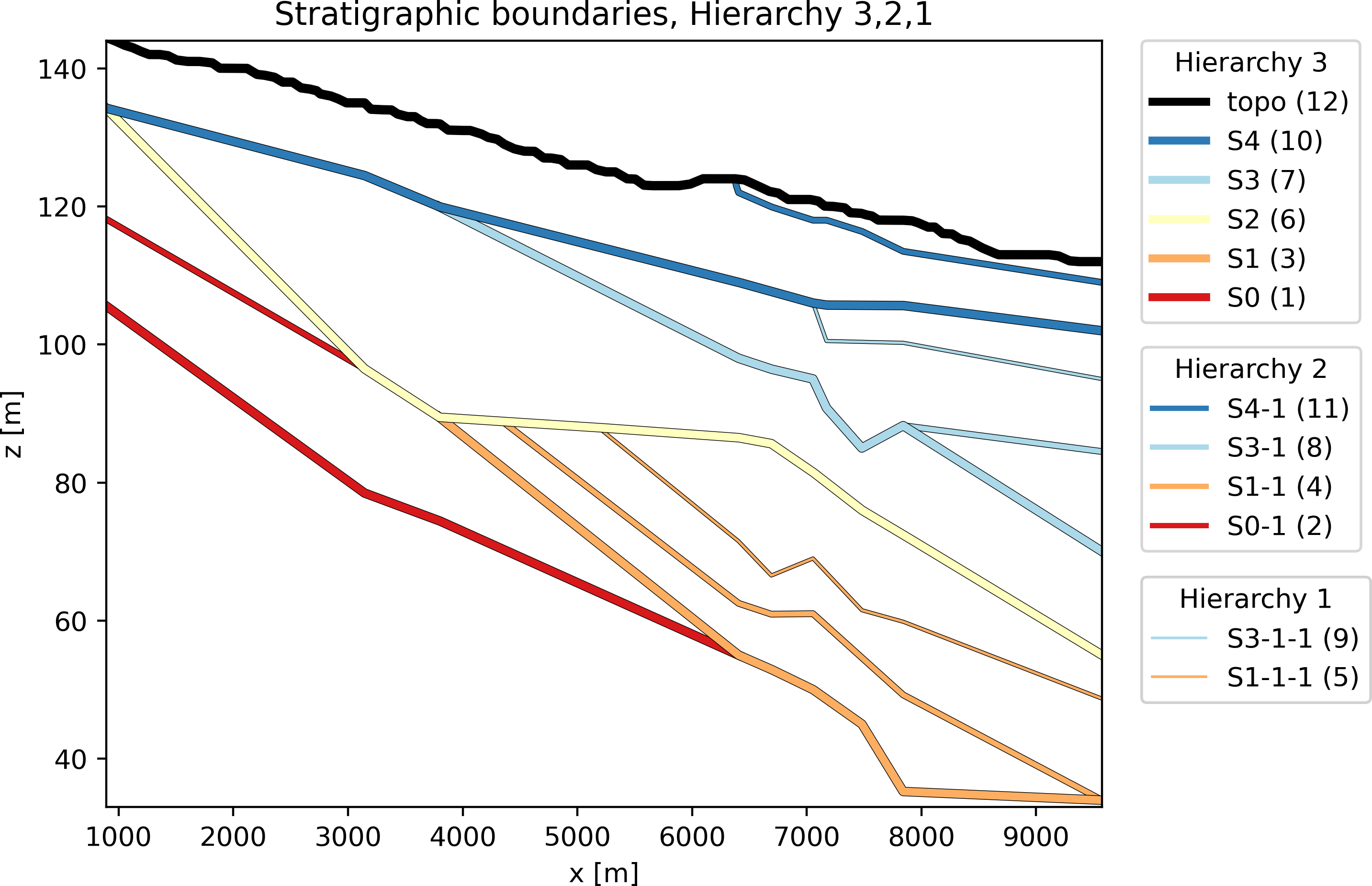
Hereinafter you can see one of the possible output provided by hiegeo, for example a representation of the geology in terms of stratigraphic boundaries (SBs) including only the 3rd level of hierarchy, the 3rd and the 2nd, and 3rd, 2nd and 1st:
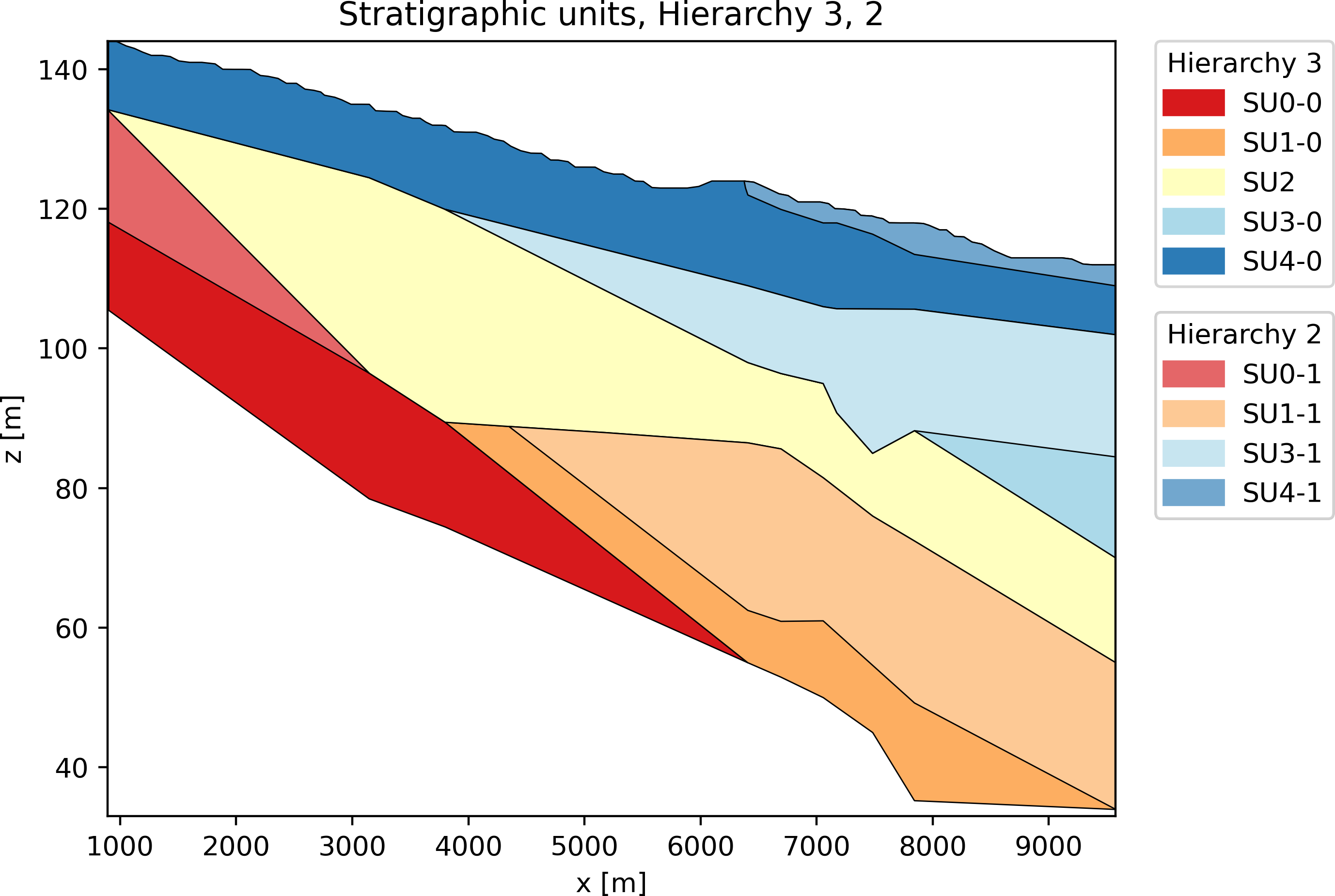
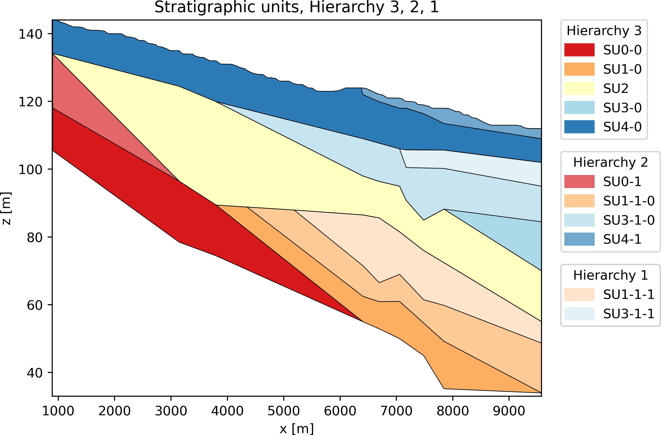
The same representation at different hierarchical levels can be obtained in terms of Stratigraphic Units (SUs):

In addition, you can also have a representation of the geological hierarchy as a tree structure: